A company that bills itself as a social network for athletes has updated its global heatmap, or a visualization of the activities of its users.
To make the map, Strava reports that it processed some 10 terabytes of raw data from its mobile app, encompassing 1 billion athletic activities, 17 billion miles, and more than 200,000 aggregate years. There's a detailed blog post covering some of the more unique and interesting plot points gathered (the course for the marathon in Antarctica, the strange patterns of Burning Man, or the channel between England and France) that is worth checking out.
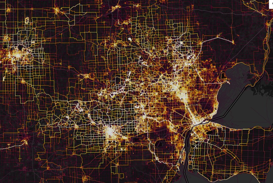
However, we wanted to see what athletic activities in Detroit looked like.
Unsurprisingly, much of Detroit's sparsely populated neighborhoods are blacked out, save for the Woodward corridor. Ann Arbor, possibly the largest pedestrian-friendly community in the region, is white-hot with activity.
In downtown Detroit, the developments of Gilbertville have reinvigorated the city's core. You can see the vestiges of the abandoned radial, honeycomb-like Woodward plan lit up with activity.
The outer perimeter of Belle Isle, a favorite of bicyclists and joggers, is also lit up.
Over in Midtown, the Cass Corridor area surrounding Wayne State shows more activity than Woodward Avenue. You can also see the oval path of WSU's Lowell Blanchard track.
Head over to Strava to investigate further.


About The Author
Lee DeVito

Leyland “Lee” DeVito is the editor in chief of Detroit Metro Times since 2016. His writing has also been published in CREEM, VICE, In These Times, and New City. He once asked porn star Stormy Daniels to spank him with an issue of Metro Times. She obliged.


All material © 2024 Detroit Metro Times, Ferndale, MI. All rights reserved.